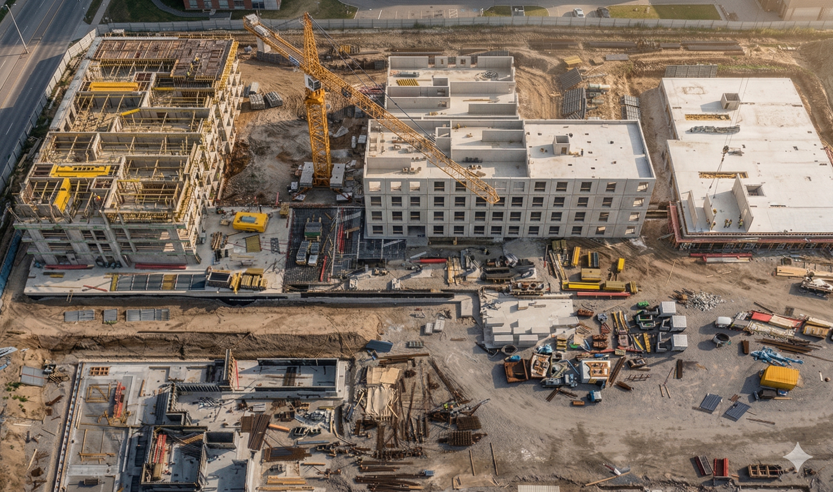
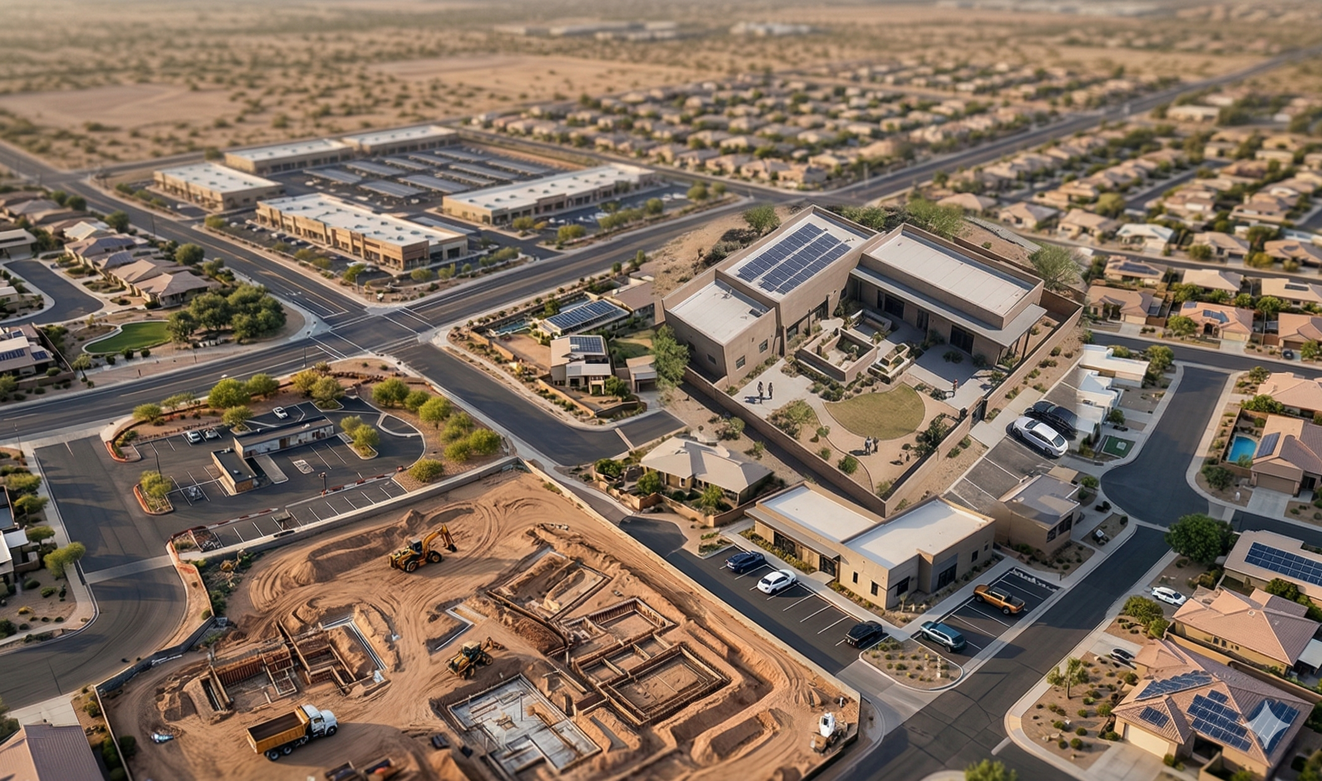
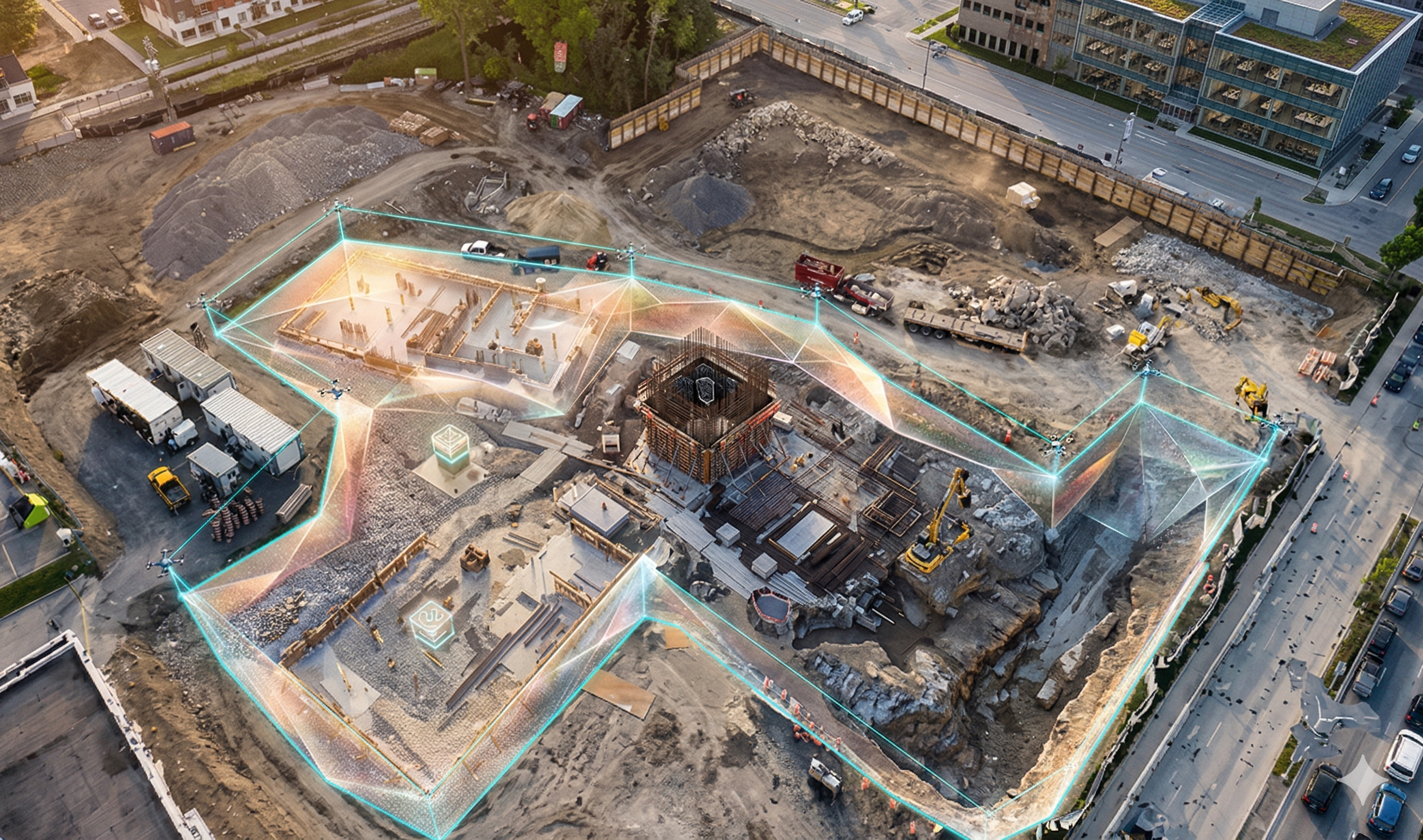
High-Level Site Visibility
Capture full-site aerial views to track progress and layout accuracy.
Faster, Safer Data Collection
Minimize survey risks and capture large areas in minutes.
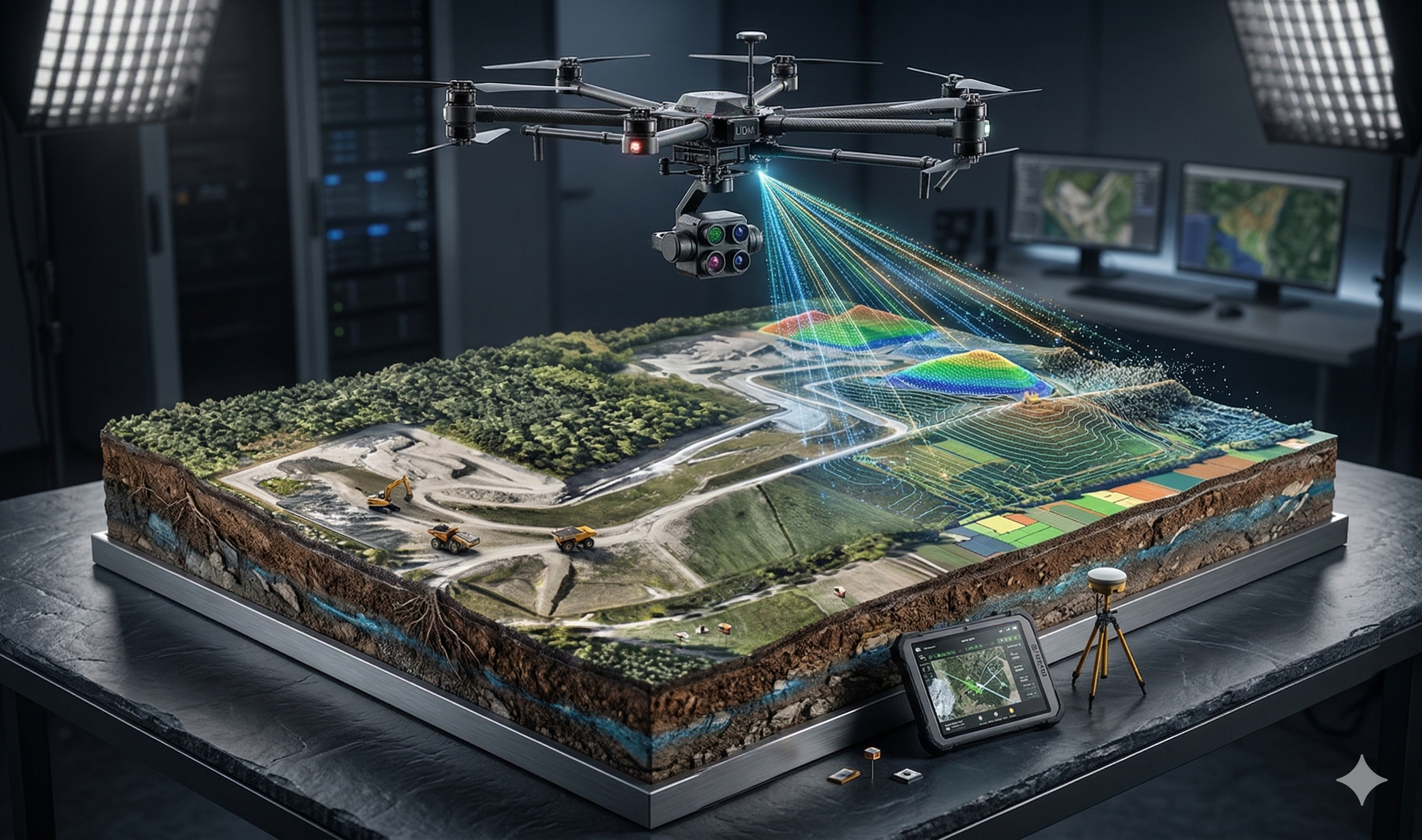
Advanced Analytics Insights
Auto-generate elevation maps, volumes, and accurate 2D/3D models.
Track Progress with Side-By-Side Flights
Compare drone data across days to track progress and productivity.
Complete Site Visibility That Drives Results
Facade & roof Inspections
Oblique imagery for defects, Safety checks, and Handover documentation.
Thermal
Radiometric orthos for water ingress, electrical & roof audits
LIDAR
Topographic Surveys, vegetation Penetration, high-accuracy modeling
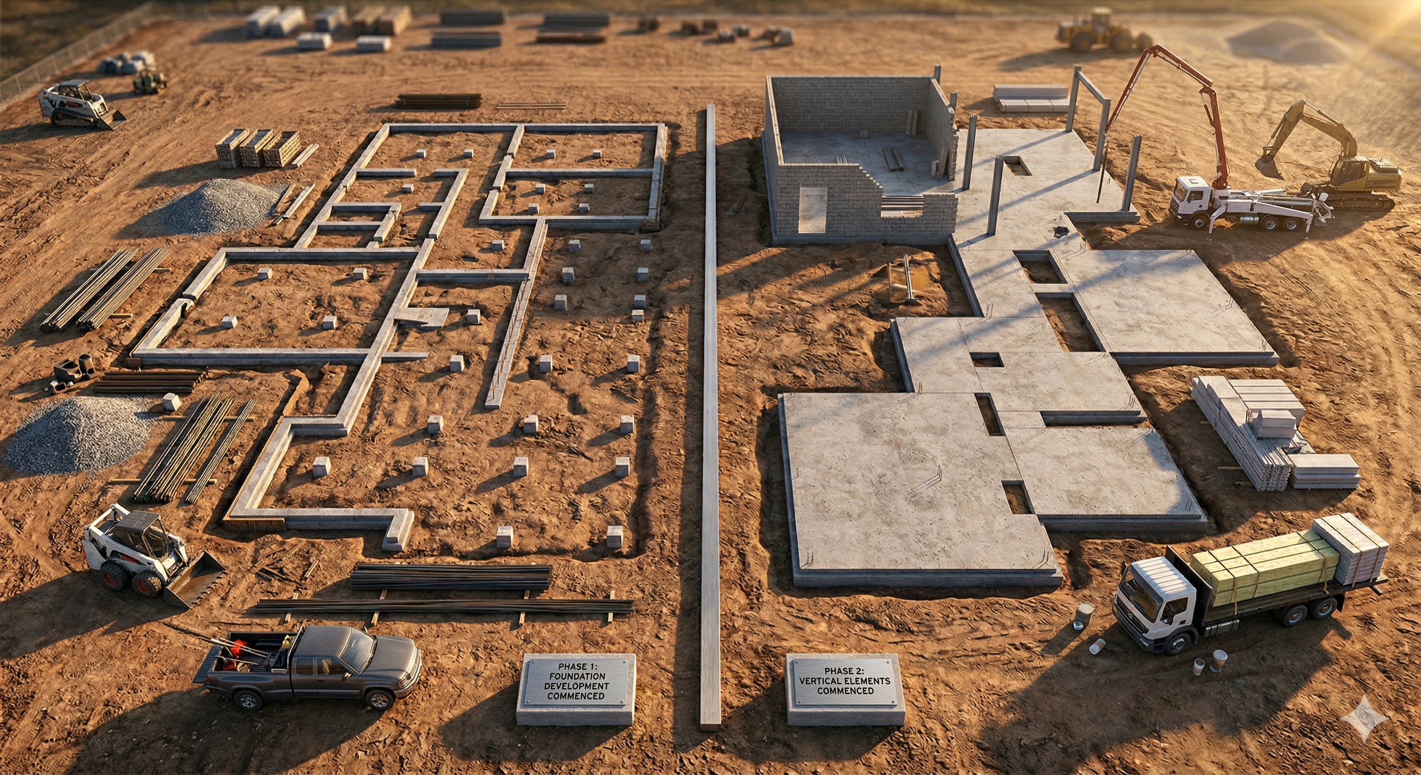
Compare Progress
Evaluate multiple drone captures side by side to track work completion.
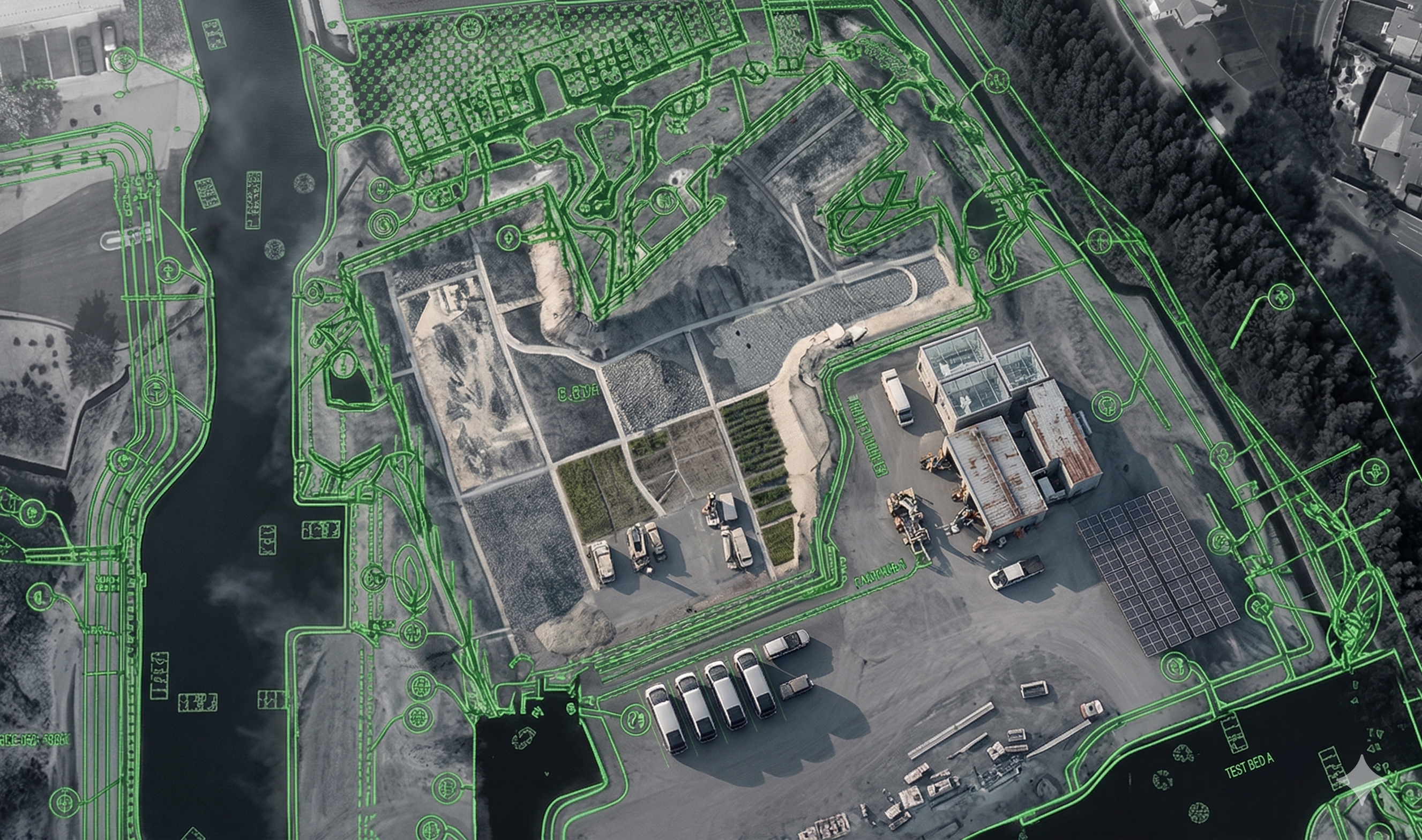
Mapped Coordination
Align aerial maps with site layouts and floor plans to ensure accurate execution.
Sticky Notes
Tag, comment, and assign tasks directly on aerial maps.
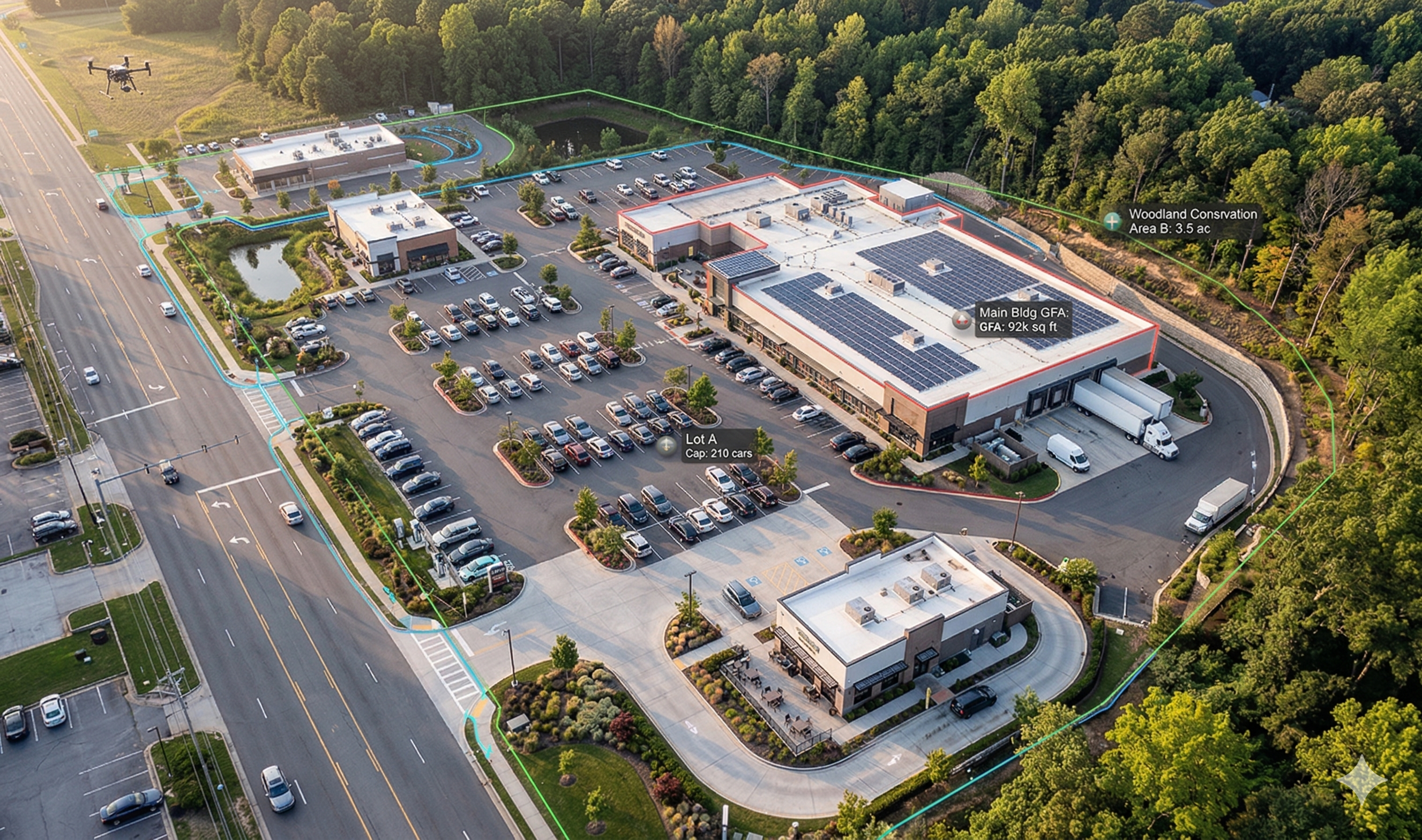
Ortho mosaic Maps (RGB)
High-resolution stitched site maps (2-5 cm/pixel).
3D Models/Point Clouds
Photogrammetry-based mesh/point cloud for as-built verification.
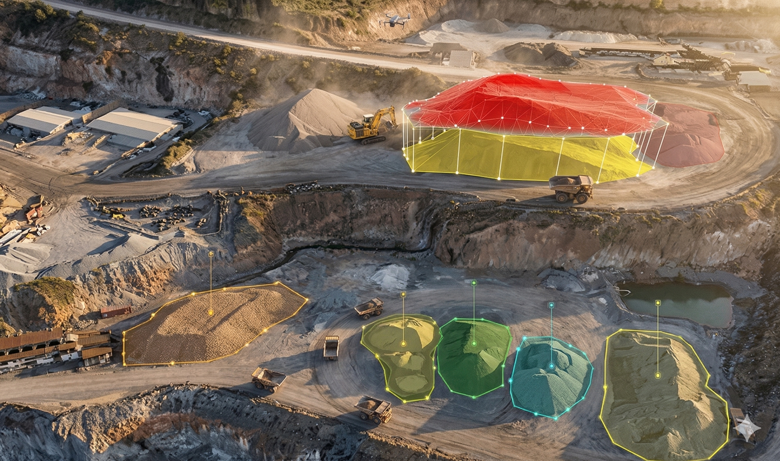
Stockpile & Earthwork Volumes
Accurate cut/fill and volumetric reports (CSV + maps).